We have listed for you some of the most popular hiking suggestions.
Combination hike
“Vineyard-outlooks-wood and stop for a bite”
walking time: ~2,5 to 3 hours
Discover a wide-ranging hiking experience. From Ihringen train station/ Kaiserstuhl Halle, go direction church where you will begin your hike on the Neunlindenpfad. The Neunlindenpfad leads you through the historical hollow path Dulltalgasse to the Lenzenberg. You can enjoy beautiful panorama views. From there it is possible to reach the Liliental (1 hour walk) by going over the Totenkopf (highest point of the Kaiserstuhl). You are now following the Knabenkrautpfad direction Himmelburg and Martinshöfe toward the so called Liliental, the forest arboretum with its exotic plants and trees (In the Liliental you can choose between further different hiking trails length from 2 to 6km), To return to Ihringen turn right at the lowest pond. You are now walking along the Mühletal through the forest passing the Schützenhaus in direction Betzental. Walk alongside the Schmerberg, through a hollow path. Your hike will stop at the Kaiserstuhlhalle.
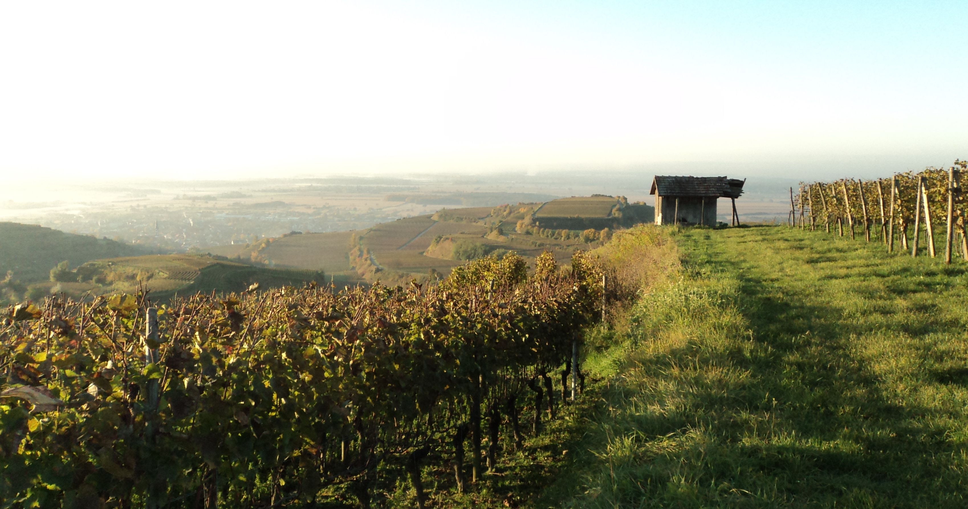
Circular hike – Lenzenberg
Length: 3,5km
Walking time: ~2h
Go from the train station or Kaiserstuhl Halle to the church. From there walk along the Bienenfresserpfad (Bee eater trail) through the Pöppigasse, a landmarked hollow path. If you continue you will cross the Knabenkrautpfad, which will lead you to your destination: the Lenzenberg. You will be rewarded with a beautiful view on the Black Forest, Vosges and in case of good visibility conditions, even the Alps. After your rest you can continue your hike on the Neunlindenpfad. You will walk through the Dulltalgasse back to the church.
Circular hike – Wasenweiler
Length: 5,5km
Walking time: ~3h
Start: Wasenweiler Train station
The trail starts at the train station of Wasenweiler through the village centre on the Steinkauzpfad and Gagenhard mountain trail to branch-off Liliental (nature trails on-site “from the sequoia to the orchis”, a good Nordic-Walking Terrain with blaized trails, possibilities to rest and eat). From the branch-off Liliental Knabenkrautpfad walk on the Hüttenweg in direction hollow trail Stalleckgasse, at the front corner alternatively go towards Ihringen (train station) – or from Schützenhaus, Lindenplatz to return to the Wasenweiler train station.
Gagenhard Mountain trail with eagle nest
Length: ~6km
walking time: ~2½ h
Start: Liliental
The hike begins in the Liliental at the Hofgut “Lilienhof”. From there on walk on the Knabenkrautpfad and pass next to the lowest pond. From the Gagenhard mountain trail hike until you cross the Neunlindenpfad. Then walk along the Neunlindenpfad toward the panoramic tower Neun Linden and follow the branch-off (yellow diamond shaped blaze) toward the Adlernesthütte (eagle nest hut). The hike continues on the Knabenkrautpfad which will take you back to Ihringen.
Panorama trail
Length: 6,5km
Walking time: ~3 ½h- 4h, (marked by a yellow diamond shaped blaze)
This panorama trail offers beautiful outlooks on the cathedral of Freiburg, which marks the Dreisamtal-valley and the gate to the Black Forest.If you let your gaze drift southwards you can see the Tuniberg and the Swiss Jura and the Vosges to the west. The hike starts at the parking place Kaiserstuhlhalle (Scherkhofenstraße) on the trail “zum Schmerberg” over the front and rear corner to the beginning of the Stalleckgasse. From there follow the Knabenkrautpfad to the Martinshöfen and Himmelburg toward the Lenzenberg. You can walk up to the Lenzenberg once you’ll have reached the winding road to the Lenzenberg; or go down to the panorama trail through historical vineyards. Both roads meet again at the hollow path “Dulltalgasse”. From there follow the Neunlindenpfad downwards where you can admire the excavated shelters and loess walls. From the Schlichtengasse (which is also a hollow path) you will reach the church of Ihringen,
Day hike Totenkopf
Length: 15km
walking time: ~5h
The hike begins at the parking place Kaiserstuhlhalle / train station direction church. From the church start on the Neunlindenpfad through the Dulltalgasse to the Lenzenberg. From there hike on the Neunlindenpfad to the Neunlinden panoramic tower. There you’ll have an beautiful outlook in all directions. The hike continues to the Totenkopf (556m high and the highest point of the Kaiserstuhl). Here you leave the Neunlindenpfad and go on the hiking trail of the Black Forest Association, marked by the yellow diamond shaped blaze, toward Bickensohl. In Bickensohl in the middle of the village is the entry point (informational sign) of the bee eater trail which you can follow toward Ihringen.


